
February 18, 2026 | 06:31 am

TEMPO.CO, Jakarta - Indonesia's East Priangan region was rocked by a tectonic earthquake with a magnitude of 4.8 early Wednesday morning, February 18, 2026, at 1:00 a.m. Western Indonesian Time (WIB). The Meteorology, Climatology, and Geophysics Agency (BMKG) reported that tremors were felt from Pangandaran to Bandung Regency.
The epicenter of the earthquake was located at 8.53 degrees South Latitude and 108.13 degrees East Longitude. "It was precisely located at sea, 100 kilometers west of Pangandaran Regency," said Hartanto, Head of BMKG Region II Tangerang, in a written statement following the earthquake.
The earthquake was relatively shallow, at a depth of 39 kilometers. According to the BMKG, the cause of the earthquake was plate subduction activity. There were no reports of a tsunami following the earthquake in the Indian Ocean south of Java or the South Sea.
Based on the BMKG's shock map estimates and public reports, the earthquake was felt by residents in Pangandaran and Tasikmalaya with an intensity of III on the MMI scale, meaning the tremors were felt inside homes as if a truck were passing by.
Meanwhile, in Garut, the tremors were felt at an intensity of II-III on the MMI scale, meaning the tremors were felt by a few people and caused light hanging objects to sway, even inside homes.
The tremors also spread to Ciamis and Bandung Regency, with an intensity of II on the MMI scale, meaning the tremors were felt only by a few people and caused light hanging objects to sway.
So far, according to the BMKG, there have been no reports of building damage as a result of the earthquake. Monitoring results as of 1:38 a.m. Western Indonesian Time (WIB) showed no aftershocks.
Read: Pacitan Earthquake: KAI Halts Trains, Denies Derailments
Click here to get the latest news updates from Tempo on Google News
Pacitan Earthquake: KAI Halts Trains, Denies Derailments
11 hari lalu

PT KAI clarifies reports of a train derailment in Yogyakarta following the Pacitan earthquake in the early hours of February 6, 2026.
Magnitude 6.4 Earthquake Hits Yogyakarta, Affecting 40 Residents
11 hari lalu

Yogyakarta's dIsaster management agency recorded at least 40 affected residents, while a number of public facilities and homes sustained damage.
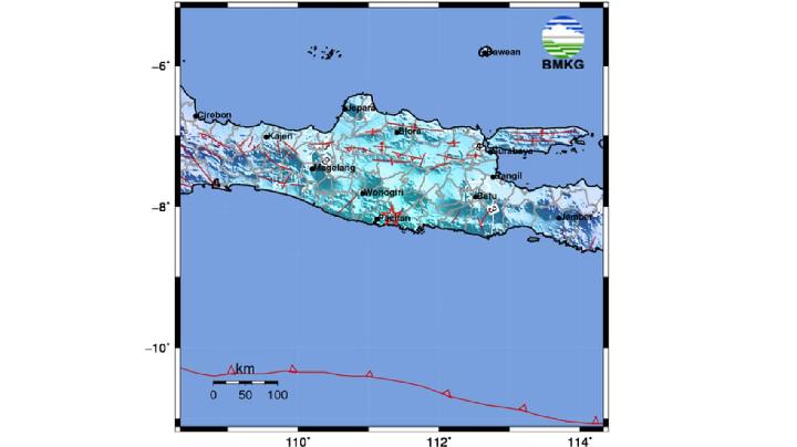
M6.2 Megathrust Earthquake in East Java, BMKG Reports No Tsunami Threat
12 hari lalu

The earthquake that occurred is a type of shallow earthquake due to subduction plate activity.
M5.4 Earthquake Jolts Maluku from Banda Sea, No Tsunami Reported
14 hari lalu
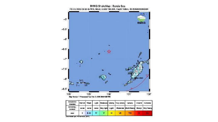
The earthquake that occurred was an intermediate earthquake caused by rock deformation in the Banda Sea Plate.
BMKG: M4.4 Earthquake Hits Mentawai Islands, Caused by Fault Activity
15 hari lalu
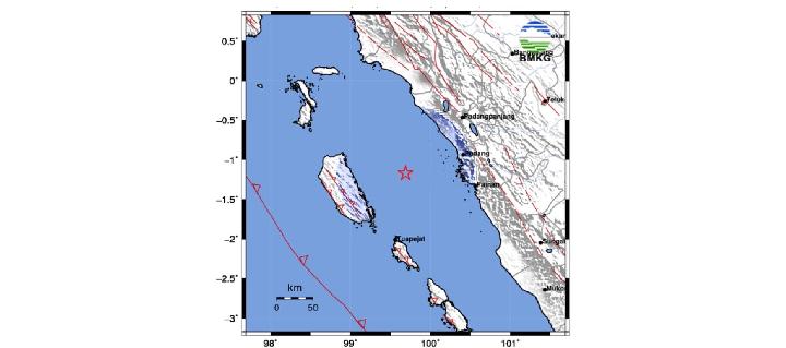
Meteorology, Climatology, and Geophysics Agency (BMKG) reported a tectonic earthquake with a magnitude of 4.4 struck Siberut Island, Mentawai Islands.
BMKG Records 97 Earthquakes in West Java During January
16 hari lalu
The Indonesian Meteorology, Climatology, and Geophysics Agency (BMKG) recorded 97 earthquakes in West Java during January 2026.
BMKG Records Earthquake in Bandung This Morning
19 hari lalu

Here are the data and explanations from BMKG regarding the earthquake.
Mount Merapi Ejects Pyroclastic Flow Hours After Earthquakes in Yogyakarta
21 hari lalu

Mount Merapi on the border of Yogyakarta and Magelang Regency emitted pyroclastic flows at 04:13 p.m. local time on Tuesday, January 27, 2026.
11 Trains Temporarily Halted After Earthquake in Pacitan, East Java
21 hari lalu
Eleven train journeys passing through the PT KAI Daerah Operasi 7 Madiun area were stopped due to an extraordinary earthquake.
Panic in Yogyakarta as M4.4 Earthquake Hits Bantul
21 hari lalu
A shallow magnitude 4.4 earthquake struck Bantul, Yogyakarta, on January 27, 2026.