January 14, 2026 | 08:49 pm
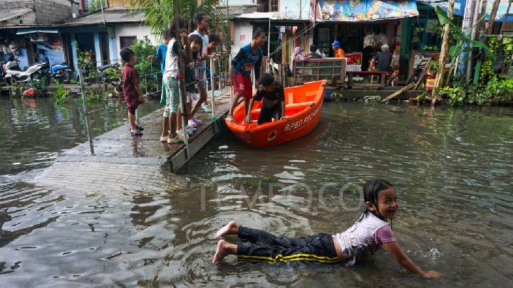
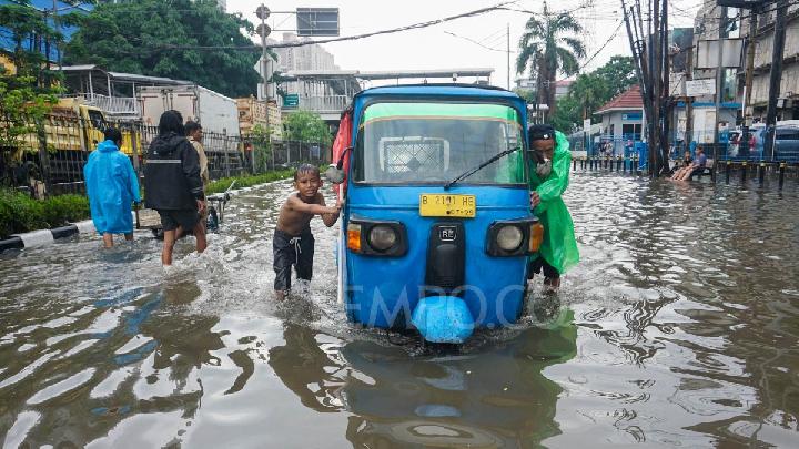
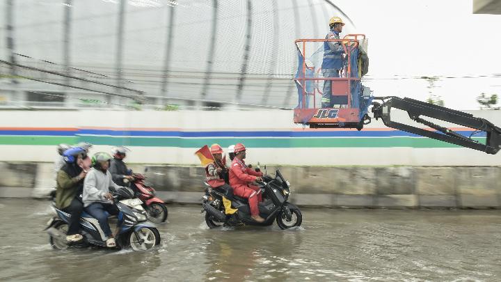
TEMPO.CO, Jakarta - Heavy rainfall across Jakarta and its satellite cities on Monday, January 12, 2026, triggered widespread flooding, paralyzing key infrastructure, including the Sedyatmo Toll Road leading to Soekarno-Hatta International Airport.
In Bekasi, an arterial road submerged in floodwater led hundreds of motorcyclists to use the toll road. Officers directed them from the Tarumajaya Toll Gate toward the Semper Toll Gate in North Jakarta.
Commissioner Sandy Titah Nugraha, Head of the Cikampek Toll Main Office, confirmed that traffic engineering was necessary to accommodate the stranded commuters. "Hundreds of motorcyclists were escorted from the Taruma Jaya Toll Gate in Bekasi to the Semper Toll Gate in North Jakarta because the Bekasi arterial roads were submerged," Sandy stated in Jakarta on Monday, January 12, 2026.
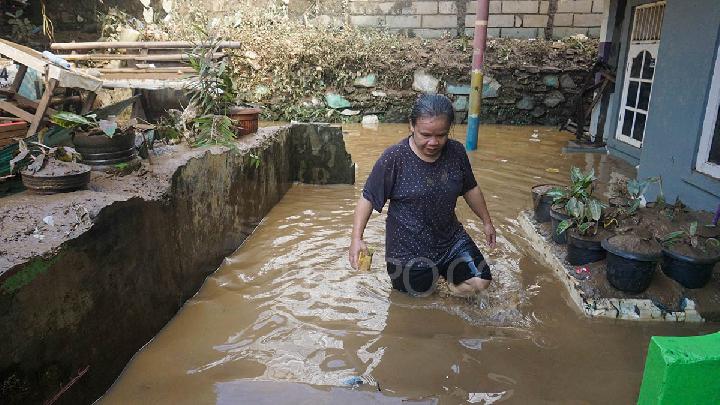
The Jakarta Regional Disaster Mitigation Agency (BPBD DKI) reported that by Tuesday morning, January 13, 2026, floodwaters continued to inundate 28 neighborhood units (RT) and six major roads. Mohamad Yohan, Head of the BPBD Jakarta Data and Information Center, attributed the persistent standing water to the sheer volume of precipitation. "Heavy rainfall has led to increased water discharge and inundation across several key sectors," Yohan noted.
Jakarta’s battle with water is an annual ordeal, fueled by environmental degradation and shifting natural phenomena. While the provincial government has deployed various countermeasures, urban planning observer Yayat Supriatna from Trisakti University argues that the city is fighting an uphill battle with an obsolete strategy. "The 1973 Jakarta flood control master plan is no longer capable of supporting current urban conditions," he remarked on Wednesday, January 14, 2026.
The crisis is deeply rooted in the loss of water absorption capacity as spatial planning increasingly favors human settlements over ecological balance. Rapid urbanization and dense population growth have effectively displaced the city's natural "water spaces," creating an inevitable conflict between infrastructure needs and hydrological realities. "Jakarta has changed; its absorption capacity has vanished as the population became denser," Yayat added.
This vulnerability is exacerbated by drainage systems that have failed to keep pace with the city’s expansion. In many high-density areas and informal settlements, water infrastructure is virtually non-existent, causing runoff to spill directly into homes and streets. Combined with land subsidence and rising sea levels in the north, structural solutions are becoming increasingly difficult to execute. "Jakarta has completely surrendered; a little rain and Jakarta gives in," Yayat lamented.
Given these physical limitations, Yayat suggests that non-structural mitigation, specifically community preparedness, is the most realistic path forward. He believes that educating residents on disaster resilience and environmental stewardship is vital. "The only thing left to do is to teach the community to be resilient in the face of these disasters," he said.
The Strategy of Reservoir Development
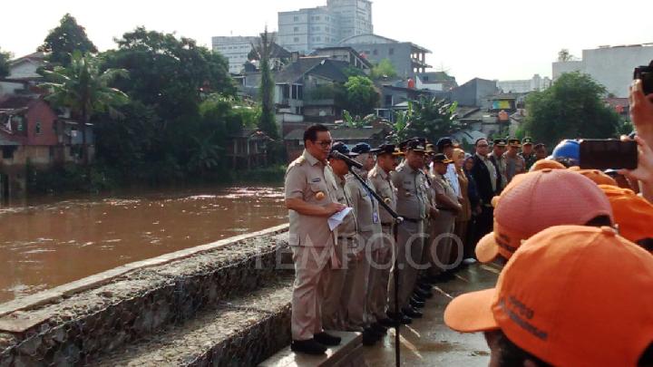
The Jakarta Provincial Government, however, continues to lean heavily on reservoir development as its primary flood mitigation pillar. These catchments are designed to intercept runoff and provide relief to congested urban centers. As part of this push, Jakarta Governor Pramono Anung recently inaugurated the Batu Licin Reservoir in Cilangkap, East Jakarta.
Spanning roughly 4.5 hectares with a capacity of 92,000 cubic meters, the Batu Licin Reservoir is touted by the local government as a success in ending routine flooding for nearby residents. "Previously, this area was always flooded during heavy rainfall," Pramono noted during a site visit on Tuesday, January 13, 2026.
Pramono framed the reservoir projects as part of a medium-term strategy integrated with the normalization of the Ciliwung, Sunter, and Krukut rivers. Supported by high-capacity pumping stations and real-time monitoring, the Governor claimed that inundations can now be cleared within 60 to 90 minutes. To support this, the city has deployed approximately 1,200 drainage pumps, split between stationary and mobile units, across high-risk zones.
The Governor emphasized that these measures are part of a multi-layered, sustainable scheme. While long-term solutions like the "Giant Sea Wall" directed by President Prabowo Subianto are being fast-tracked to address coastal subsidence, Pramono maintains that the current alert system is effectively managing the impact of extreme weather. "Because we are always on alert, the impact can be more easily controlled," he said.
However, critics remain skeptical. Public policy observer Trubus Rahadiansyah argues that the government’s efforts are falling short as the number of flood points continues to grow. He observed that areas previously considered safe are now frequently underwater due to the inadequacy of the existing drainage network under extreme stress.
"The policies are ineffective; the number of flood points has increased," Trubus stated on Wednesday. He contends that reservoirs, pumps, and the sea wall concept fail to address the core problem. According to him, true improvement requires the political courage to significantly expand water catchment areas and relocate settlements that currently obstruct natural water flow.
Read: Jakarta Governor Says Batu Licin Reservoir Effective in Flood Control
Click here to get the latest news updates from Tempo on Google News
Three Die from Electric Shock During North Jakarta Floods
1 hari lalu
Three residents in Cilincing, North Jakarta, including a married couple, died from electric shock while cleaning their flooded homes on January 12.
Jakarta Floods: 28 Neighborhoods and 44 Roads Submerged
2 hari lalu
BPBD Jakarta reports that heavy rainfall has flooded 28 neighborhood units (RT) and 44 road sections across the capital as of Monday, Jan. 12, 2026.
Governor Pramono Anung Apologizes Amid Persistent Flooding Crisis
8 Juli 2025
Jakarta Governor Pramono Anung considers floods an "inevitability" in Jakarta.
Jakarta Flooding Update: 12 Neighborhood Units Remain Submerged
7 Juli 2025
The head of BPBD Jakarta confirmed that the flooding was primarily caused by heavy rainfall since Monday afternoon and overflowing rivers.
Jakarta Floods: 54 RTs and 23 Roads Still Submerged
29 Januari 2025

The BPBD has deployed teams to closely monitor all areas still affected by flooding following heavy rainfall on Tuesday night, January 28, 2025.
Jakarta Flood; West Jakarta's Tegal Alur Still Inundated Since Last Night
2 Maret 2023

Jakarta Regional Disaster Mitigation Agency (BPBD) reports that Tegal Alur District of West Jakarta was still flooded as of 11:00 local time today.
Jakarta Floods Spread to 104 Neighborhoods, 5 Roads
27 Februari 2023

Jakarta areas hit by floods expanded from 82 neighborhood units (RT) to 104 RT as of 13:00 hours local time, Monday, February 27, 2023.
Jakarta Floods Spread to 28 Neighborhoods, 3 Streets: BPBD
4 Januari 2023

The Jakarta Disaster Mitigation Agency (BPBD) records that 28 neighborhood units or RT and 3 roads in the capital were flooded as of 6 p.m. today.
Jokowi Claims 2 Bogor Dams Can Reduce Jakarta Flood Exposure
23 Desember 2022

President Jokowi claimed that the two newly-inaugurated dams in Bogor can reduce the number of Jakarta areas exposed to flooding.
Ciawi, Sukamahi Dams Will Reduce Jakarta Floods by 30.6%: Jokowi Says
23 Desember 2022

President Jokowi stated today that the Ciawi Dam and Sukamahi Dam in Bogor Regency will significantly reduce the Jakarta floods.